Remote Sensing Courses
Remote sensing courses can help you learn about satellite imagery analysis, geographic information systems (GIS), and environmental monitoring techniques. You can build skills in data interpretation, spatial analysis, and remote sensing applications in agriculture and urban planning. Many courses introduce tools like ArcGIS and QGIS, along with software for processing satellite data, that support analyzing and visualizing geographic information.
Popular Remote Sensing Courses and Certifications
Birla Institute of Technology & Science, Pilani
Skills you'll gain: Environment, Environmental Resource Management, Sustainable Development, Environmental Issue, Environmental Policy, Climate Change Programs, Environmental Science, Environmental Management Systems, Water Sustainability, Natural Resource Management, Sustainable Business, Environmental Monitoring, Waste Minimization, Climate Change Mitigation, Climate Change Adaptation, Pollution Prevention, Systems Thinking, Biology, Stakeholder Engagement

Google Cloud
Skills you'll gain: Apache Spark, PySpark, Google Cloud Platform, Cloud Management, Cloud Computing, Distributed Computing, Package and Software Management
University of Geneva
Skills you'll gain: General Science and Research, Scientific Methods, Scientific Visualization, Research, Quantitative Research, Physics, Mathematical Modeling, Simulations, Mechanics, Chemistry
Universidad Nacional Autónoma de México
University of Colorado Boulder
Skills you'll gain: Climate Change Adaptation, Corporate Sustainability, Environmental Resource Management, Environment, Social Impact, Adaptability, Action Oriented, Community Development, Water Resource Management, Risk Analysis, Environmental Science, Sustainability Reporting, Vulnerability
University of Michigan
Skills you'll gain: Sustainable Development, Social Justice, Sustainable Systems, Geographic Information Systems, Organizational Change, Sustainable Business, Environmental Policy, Environmental Regulations, Geospatial Mapping, Culture Transformation, Organizational Effectiveness, Sustainability Reporting, Spatial Data Analysis, Environmental Social And Corporate Governance (ESG), Environmental Issue, Strategic Leadership, Leadership, Collaboration, Financial Analysis, Critical Thinking

Skills you'll gain: Data Visualization

MathWorks
Skills you'll gain: Image Analysis, Matlab, Computer Vision, Traffic Flow Optimization, Automation, Anomaly Detection, Data Preprocessing, Data Store

Skills you'll gain: Transfer Learning, Computer Vision, Image Analysis, Data Cleansing, Data Pipelines, Data Transformation, Data Manipulation, Exploratory Data Analysis, Artificial Intelligence and Machine Learning (AI/ML)
DeepLearning.AI
Skills you'll gain: Model Evaluation, Applied Machine Learning, Image Analysis, Environmental Monitoring, Convolutional Neural Networks, Artificial Intelligence, Climate Change Mitigation, Artificial Neural Networks, Forecasting, Computer Vision, Predictive Modeling, Data Preprocessing, Environmental Science, Supervised Learning

Skills you'll gain: Spatial Data Analysis, Geographic Information Systems, Geospatial Information and Technology, Geospatial Mapping, Data Analysis, Big Data, Data Visualization, Analytics, Google Cloud Platform, Network Analysis, Cloud Management, Data Access, Query Languages
University of California, Davis
Skills you'll gain: ArcGIS, Data Storytelling, Spatial Data Analysis, Data Presentation, Geographic Information Systems, Spatial Analysis, Geospatial Mapping, Heat Maps, Data Visualization Software, Network Analysis, Data Manipulation
In summary, here are 10 of our most popular remote sensing courses
- Environmental Studies: Birla Institute of Technology & Science, Pilani
- Distributed Image Processing in Cloud Dataproc: Google Cloud
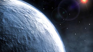
- The Diversity of Exoplanets: University of Geneva
- Espectroscopía infrarroja: Algoritmo de interpretación: Universidad Nacional Autónoma de México
- Planning with Climate Change in Mind: University of Colorado Boulder
- Green Skills for a Sustainable and Just Future: University of Michigan
- Data Processing, Exploratory Analysis and Visualization: Microsoft
- Automating Image Processing: MathWorks
- Optimize Vision Datasets: Augment and Analyze: Coursera
- AI and Climate Change: DeepLearning.AI


